

Drones Battle Disease, Waste and Cattle Rustlers on US Farms
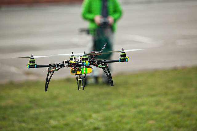
Farmers and ranchers across the globe are turning to unmanned aerial vehicles (UAVs) to assist with farming. As technology improves, so will the applications for UAV technology, writes Rachel Lane.UAV’s, commonly referred to as drones, can be used to assist farmers with grazing rotations, identify sick cattle, even stop cattle rustlers from stealing cattle, said Robert Blair, VP of agriculture for Measure, a UAV company focused on assisting farmers.
“There are so many things we can do with this technology, we haven’t even scratched the surface," he said.

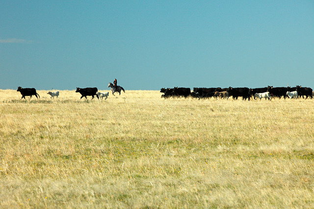
Several years ago, the police asked for help to watch for cattle rustlers during inclement weather. The same technology can be used to check fence lines for damage, find lost cattle or identify a herds location when a farmer is ready to move the cattle to a different pasture.
Using UAVs with thermal imaging, a cow in heat can be identified in a herd. The same technology - an increase in temperature - would allow a farmer to tell if a cow is sick, possibly preventing a disease from spreading to other cattle.
Mr Blair thinks the technology will advance enough that a device will be attached to the UAVs, fly over the cattle in the field, and spray pesticides or other pest-deterrents directly onto the herds.
With current technology, aerial images can help farmers with precision agriculture decisions involving grazing patterns and growth in fields. Mr Blair said he first noticed the benefit in 2004 when he was flown over his fields for the first time.
“I was able to see so many different things that I couldn’t see from the ground and it was absolutely amazing,” he said, but it was costly.
In 2006, he realised he could buy a drone for the cost of two flights over his entire farm. After purchasing the drone, he spent the first year trying to learn to fly it, land it, and interpret what he was looking at in the images he collected.
In 2007, he was able to use the data collected the previous year to figure out how to read the images, when he needed to make flights, and how to make changes needed to maximise his crop.
“It helps me understand what's going on and to see issues that I would not have found,” Mr Blair said.
At one point, he realised the man on the fertiliser machine was turning it off and turning it on at the wrong times, trying to save money by limiting the use of fertiliser. He was losing about 20 bushels of wheat per acre (roughly half a hectare) of land, which translated into roughly $100 [£75] per acre. He was able to show the man the images and the man understood the issue.
Mr Blair said the data can be hard to understand, which is why Measure has data specialists that work the data into maps and crop advisors, experts on crop nutrition and pesticides, to help make recommendations for the farmers. The farmer then uses the information, with his or her own knowledge, to determine the best course of action.
Christine Su, founder and CEO of PastureMap, said her company uses similar images and data to form easily understood information for cattle ranchers.

She became interested in the project when she realised many ranchers are raising carbon negative beef as a result of grazing practices.
“(The grass) sucks down carbon like a mini forest… and puts it in the ground,” Ms Su said.
She started the company in 2014. The company tracks and records the information for the farmers.
Over 1,000 ranchers in 10 countries use the data to track grazing records, grass growth, and invasive weeds. Enough data has been collected that the information can now be shared anonymously with other users, Ms Su said.
“We give them piece of mind that they’re keeping accurate records,” she said. And it saves the ranchers time figuring out what is working and what’s not.
The imaging helps farmers learn which fields are growing faster and recovering faster after the cattle have grazed. In the future, farmers will be able to tell exactly how much grass is on the land, how many head of cattle can graze, and for how long a period of time, she said.
“I think aerial imaging is an inevitable part of farming,” she said.
Ms Su said her company has partnered with TerrAvion, using high-resolution images utilising Normalised Difference Vegetation Index (NDVI), colour infrared, and thermal filters.
“Imagery helps you make the right calls, helps the manager cover more ground,” said Robert Morris, co-founder of TerrAvion. “It’s about making farmers and ranchers more efficient.”
Mr Morris said there are seven operating locations, with multiple planes at each site. The planes produce images slightly better than the quality provided by Google maps, but weekly, allowing farmers to identify problems and react quickly to make improvements.
“The fundamental problem in all of agriculture is there’s one dude and he has a lot of land,” Mr Morris said. “You’ll spend a lot of time trying to figure out what to do next.”
The planes view of the farms can help farmers make decisions to increase the biomass of each acre (hectare) of land by managing crop rotations, and herbicide and pesticides use.
Fred Zhang, vice president of range land, pasture land and federal lands at TerrAvion, said the data collected helps farmers manage the grazing systems.
“You want to see the health of the (area) before the cattle graze and after,” he said. “Is the paddy of grass healthy and is there enough of it to support the cattle?”
The information helps farmers maximise the use of their pastures by identifying areas that need to be seeded at the beginning of the growing season, he said.
As the season progresses, the images assist farmers in monitoring and tracking invasive species of plants, which can take away from the productive land a farmer can use for grazing.
The information is delivered to a farmer digitally and accessible on a computer or a smartphone.
“If you’re a rancher and you’re covering 5000 acres, you want to be able to pinpoint problems and follow up as quickly as possible,” Mr Zhang said.
Current laws in the US limit flying of UAVs to line-of-sight, meaning the distance the UAV can fly in any direction is limited. A recent change in US law does make it easier to fly a UAV more advanced than the basic toy drone.
Mr Blair said a pilot's license is no longer required, but a drone operators license is needed. And, rather than trying to schedule flights with flight control, it is possible to contact a regional airport to clear the flight.
“We call the regional airport manager… and say ‘We’d like to fly this location, at this time. We’ll be in contact with you on the radio the entire time,” Mr Blair said. The operator receives permission for the flight and a call sign. During the flight, the operator is on the same radio channel as the pilots.
He stressed the importance of knowing the local laws before anyone attempts a flight.
“I don’t want to see anyone in agriculture getting into trouble, even if they are flying over their own land,” he said.


